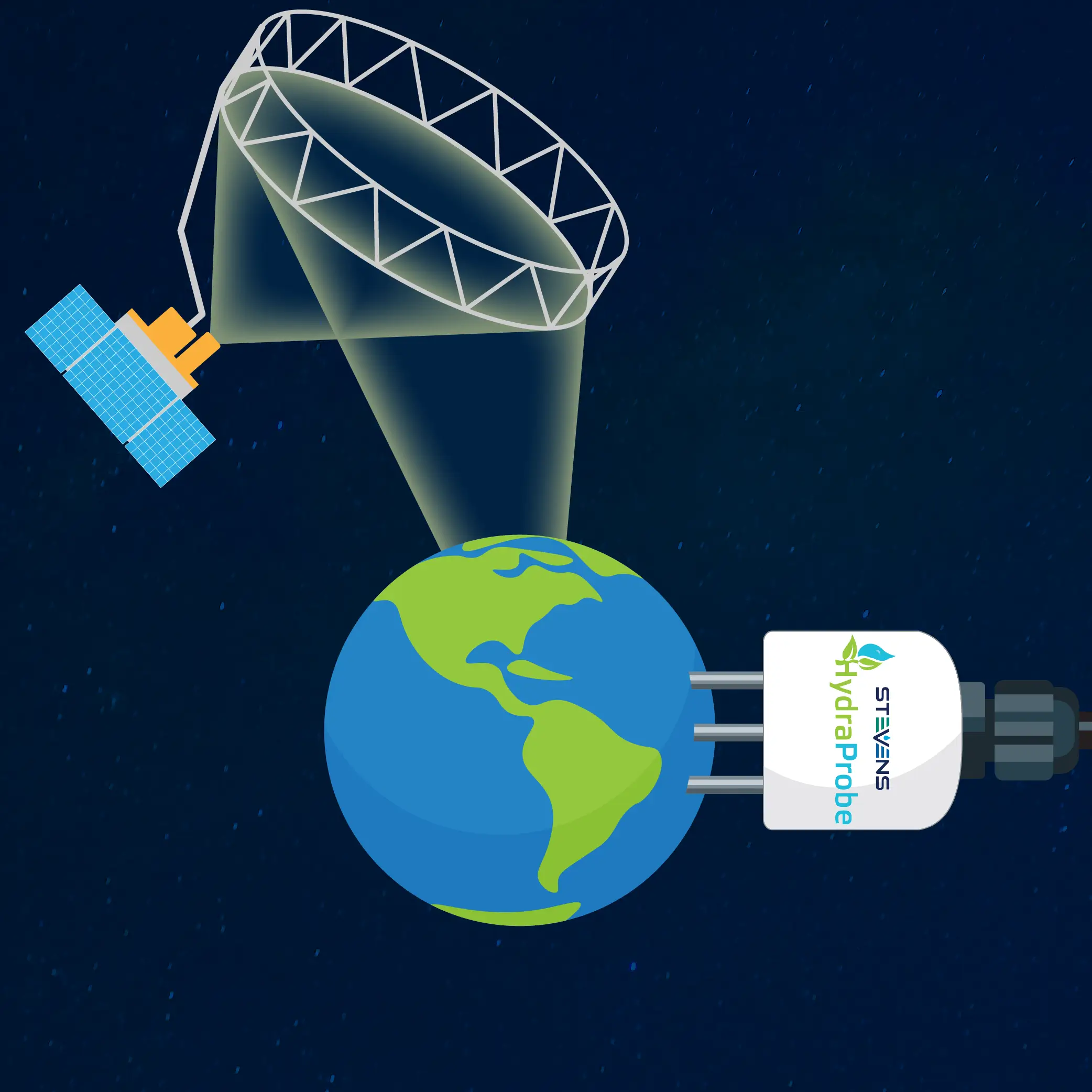
When you think of soil moisture monitoring, do satellites orbiting hundreds of miles above Earth come to mind? Measuring soil moisture from space depends on accurate measurements taken right here on the ground.
The HydraProbe soil sensor, developed by Stevens Water Monitoring Systems, has been used in scientific research to validate soil moisture measurements collected by NASA’s Soil Moisture Active Passive (SMAP) mission.
This connection between ground-based sensing and satellite observation highlights the importance of reliable, research-grade technology in advancing our understanding of Earth’s water systems.
Measuring Soil Moisture from Space
The Soil Moisture Active Passive (SMAP) mission was launched by NASA in 2015, designed to measure the amount of water stored in the upper layer of soil across the globe.
By collecting soil moisture data over vast geographic areas, SMAP helps scientists better understand:
- Drought conditions and water availability
- Flood forecasting and hydrological processes
- Agricultural productivity and crop conditions
- Weather patterns and environmental change
- Long-term climate trends and research
Satellite observations provide a valuable view of soil moisture across regions that would be difficult to monitor using ground-based sensors alone.
However, these measurements raise an important question: How can scientists verify that satellite observations accurately reflect conditions on the ground?
The answer lies in ground truthing.
What Is Ground Truthing?
Ground truthing is the process of comparing remotely collected measurements such as satellite observations with measurements taken on the ground.
For soil moisture research, scientists use ground-based sensors to measure the water content of soil at designated research sites. These measurements are compared with satellite observations to evaluate their accuracy and reliability.
Because satellite instruments observe large areas and ground sensors measure conditions at specific locations, researchers must carefully account for differences in measurement scale and local soil conditions.
Ground-based measurements are an essential part of this process. They help researchers evaluate satellite data, improve measurement techniques, and strengthen confidence in large-scale environmental observations.
The HydraProbe: Bringing Research-Grade Accuracy to the Ground
The HydraProbe Soil Sensor provides accurate soil measurements for scientific research and environmental monitoring applications.
Developed through scientific and engineering collaboration involving the USDA, Dartmouth College, the U.S. Department of Defense, and Stevens Water Monitoring Systems, the HydraProbe has a long history of supporting research that depends on accurate soil data.
Its patented design measures soil moisture, electrical conductivity (EC), and salinity index without requiring soil-specific calibration. The sensor’s marine-grade stainless-steel tines and consistent measurement performance make it well suited for demanding field conditions and long-term monitoring applications.
These capabilities are especially valuable in research settings, where repeatable measurements help scientists compare observations across locations, soil types, and changing environmental conditions.
In the context of satellite validation, reliable ground-based measurements provide an important reference for evaluating remotely sensed soil moisture data.
Connecting Ground Measurements to Global Research
NASA’s SMAP mission demonstrates how ground-based sensors and satellite technology advance environmental science.
Satellites provide broad geographic coverage to help scientists observe patterns across entire regions. Ground-based sensors deliver direct measurements of local soil conditions that can be used to evaluate those observations.
Together, these technologies help researchers build a more complete understanding of soil moisture and the movement of water through Earth’s environment.
Soil measurements have applications well beyond satellite validation. Researchers, agricultural professionals, and environmental monitoring teams rely on dependable soil data to study water availability, understand changing conditions, and support informed resource management.
The HydraProbe’s use in scientific research reflects the importance of reliable measurements in connecting local observations with a broader understanding of our planet.
Science You Can Trust
Understanding Earth’s water systems requires more than sophisticated satellite instruments; it also relies on accurate measurements collected on the ground.
Stevens Water Monitoring Systems develops monitoring technology designed to support consistent data collection across scientific research, agriculture, and environmental applications. The HydraProbe’s role in soil moisture research illustrates how ground-based sensing contributes to a better understanding of environmental conditions: from individual research sites to observations collected across the globe.
From soil moisture studies to satellite data validation, dependable measurements are the foundation of meaningful scientific insight.